NAVIGATION-CHARTS-BOOKS
-

Plastimo 4 1/2" Barometer with Solid Brass Case
Plastimo
Current Stock: 2€249.95Plastimo 4.5" high sensitivity aneroid barometers, with an entirely metallic chain and with a heavy duty brass case. Size Front facia Ø : 10 cm Base Ø : 12 cmP31230€249.95 -
Special OfferSmaller crafts


Plastimo Iris 100 Compass - Yellow Trim
Plastimo
Current Stock: 5Now €99.95Was €104.95The Plastimo Iris 100 is a truly universal compass and can be used a hand bearing or course compass. It is ideal on sailboats (dinghy, sportsboat, small cruiser), small crafts (kayak, canoe, fishing) or RIBs and even fast motor cruisers, due to...P63876Now €99.95Was €104.95 -
Powerboats 5-10mUniversal
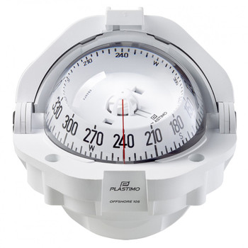

Plastimo Offshore 105 Compass - White - Flushmount - Conical Card White
Plastimo
Current Stock: 10€154.95The famous Offshore 105 Compass with built-in articulated hood, is very popular on open dayboats, RIBs, powercruisers and catamarans. It adapts to all steering pods or dashboards and offers optimal readability. Magnetic cell construction features shock...P65003€154.95 -
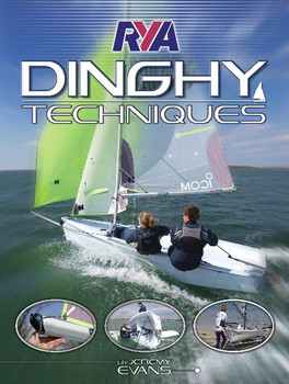
RYA Dinghy Sailing Techniques G93
RYA
Current Stock: 1€19.95Featuring seven experts sailing six popular modern single-handed and twin-crewed dinghies this is for sailors who want to develop their knowledge, understanding, and sailing expertise.From the novice wanting to get to grips with the basics to the...49162/2€19.95 -
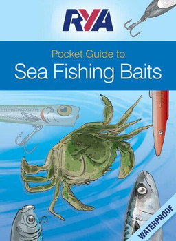
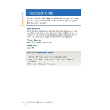
RYA Pocket Guide to Sea Fishing Baits (G91)
RYA
Current Stock: 0€10.95RYA Pocket Guide to Sea Fishing Baits (G91). This handy little pocket guide goes through the different types of sea bait and how and when they should be used to ensure that the right type is being used to catch the right species. The...49167/2€10.95 -
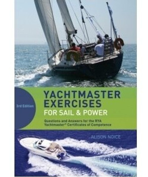
RYA Yachtmaster Exercises for Sail and Power
RYA
Current Stock: 1€30.00This companion volume to Yachtmaster for Sail and Power provides further navigation practice for anyone studying for the RYA Yachtmaster syllabus and for Day Skipper. It is packed with exercises and answers, including over 50 model plots and comes with a...49291/2€30.00 -

ADMIRALTY Chart 2767: Porturlin to Sligo Bay and Rathlin O'Birne Island
Admiralty
Current Stock: 1€46.95ADMIRALTY Chart 2767: Porturlin to Sligo Bay and Rathlin O'Birne Island Specifications Scale: 1:75000 Manufacturer: ADMIRALTY Publisher: ADMIRALTY Author: UK Hydrographic Office Edition: Jan-19 Format: Folded to...49720/05€46.95 -
 €15.95
 -

First Aid at Sea Handbook
Current Stock: 3€15.95This fully updated new edition of First Aid at Sea provides an easy-to-access instant guide to emergency first aid for all seafarers. Features Colour coded thumb index of emergencies for quick reference Concise descriptions of medical...49257€15.95 -

Imray C10 Western English Channel Passage Chart
Imray
Current Stock: 3€34.95Imray C10 Western English Channel Passage Chart Specifications Scale: 1:400,000 WGS 84 Author: Imray Publisher: Imray ISBN: 9781786790033 Edition date: 2018 Publication details: Sheet size 787 x 1118mm. Waterproof. Folded in...49510€34.95 -
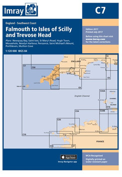
Imray C7 Falmouth to Isles of Scilly and Trevose Head Chart
Imray
Current Stock: 3€34.95Imray C7 Falmouth to Isles of Scilly and Trevose Head Chart Includes Newquay Bay (1:10 000) Saint Ives (1:15 000) St Mary’s Road (1:25 000) Hugh Town (1:10 000) Mousehole (1:5000) Newlyn Harbour (1:12 000) Penzance (1:12 000) Saint Michael’s...49507€34.95 -
Imray Norie's Nautical Tables
Imray
Current Stock: 2€33.00Since J W Norie published the first edition of this famous set of mathematical tables in 1803, the book has become – and remained - a bestseller. Despite developments in electronic navigation it remains an essential requirement for anyone learning...49565/9€33.00 -
Special OfferSailboats 9m+Universal

Plastimo Contest 101 Compass - Black - Inclined Bulkhead - Conical Card Black
Plastimo
Current Stock: 4Now €166.95Was €172.95The Plastimo Contest 101 is the No 1 best-selling sailboat compass in the world and it adapts perfectly to today's yachts, both in terms of engineering technique and glamorous design. With its interior and exterior double reading, large crisp card and...P64422Now €166.95Was €172.95 -
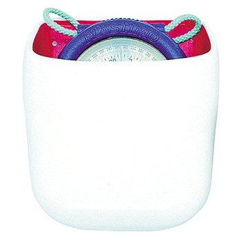
Plastimo Iris 50 Compass PVC Holder
Plastimo
Current Stock: 0€7.95This Plastimo PVC Holder is specifically designed to take the Iris 50 handbearing compass, perfect for mounting in the cockpit.P17244€7.95 -
Special OfferPowerboats 10m+SOLAS-MED approvedUniversal

Plastimo Offshore 135 Compass - Black - Flushmount - Flat Card Black
Plastimo
Current Stock: 4Now €154.95Was €161.95Plastimo Offshore 135 Compass - the famous XXL offshore compass with built-in articulated hood, mounted on most day boats, RIB's, power cruisers and catamaran. It adapts to all steering pods or dashboards and offers optimal readability. Magnetic cell...P65350Now €154.95Was €161.95 -
Universal
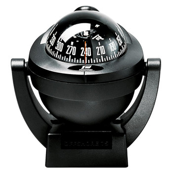

Plastimo Offshore 75 Compass - Black - Bracket Mount
Plastimo
Current Stock: 1€87.95The Plastimo Offshore 75 compass benefits from Plastimo's invaluable experience in compass engineering. Whatever the boat speed or vibrations, the Offshore 75 remains fully efficient, thanks to the exclusive "Vibration Absorber" system which guarantees...P63865€87.95 -
Powerboats 6-10mUniversal

Plastimo Offshore 95 Compass - White - Bracket Mount - Conical Card Black
Plastimo
Current Stock: 9€125.00Whatever the boat speed or vibrations, the Offshore 95 Compass remains fully efficient. This is thanks to the exclusive 'Vibration Absorber' system guaranteeing exceptional card stability in all conditions. Features Card Outstanding legibility under all...P65740€125.00 -

Plastimo Offshore 95 Compass Cover - White
Plastimo
Current Stock: 3€6.95Protective cover for power boat compass Offshore 95. Features White plastic cover Included with original compass. Proposed here as spare part Specifications Material: Plastic Colour: WhiteP55402€6.95 -

Plastimo Windy Handheld Anemometer 49357
Plastimo
Current Stock: 0€149.95Plastimo Windy is a unique handheld anemometers for simple wind speed and temperature measurement. The 3 Cup rotor allows omni-direction, wind speed measurement Features Shows current, average and maximum wind speed All standard units (knots, m/s,...P49357€149.95 -

RYA G25 Diesel Engine Handbook inc CD Rom
Current Stock: 1€22.95The latest edition to the best selling RYA Handbook series is written for the leisure boat owner. Easy to follow text and beautifully detailed colour illustrations enable the reader to develop the knowledge and confidence required by all diesel engine...49250/1€22.95 -
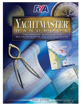
RYA Yachtmaster Handbook G70
Current Stock: 2€26.99The RYA Yachtmaster Books' examination is the gold-standard qualification for sail and power boaters the world over. This book is the RYA’s official and definitive guide to the exam. It offers a unique insight into what you need to know, how the...49291/3€26.99 -

Southern Ireland Cruising Companion
Imray
Current Stock: 0€34.95Southern Ireland Cruising Companion With its wide open seas, plentiful, secluded anchorages, beautiful scenery, & interesting navigational challenges, the southern coast of Ireland is nothing short of a yachtsman's paradise. It includes detailed s of ever49566/5€34.95 -

A Short Walk Moon & Tide Clock - with Chalk
ashortwalk
Current Stock: 0€35.95The innovative and convenient clock tracks both the tide and the lunar cycle, ideal for predicting tide times and all important harbour tide heights. As the moon determines the size of the tides, this clock will help you predict how big the tide is...56279€35.95 -

ADMIRALTY Chart 1104: Bay of Biscay
Admiralty
Current Stock: 1€46.95ADMIRALTY Chart 1104: Bay of Biscay Specifications Scale: 1:1000000 Manufacturer: ADMIRALTY Publisher: ADMIRALTY Author: UK Hydrographic Office Edition: Nov-13 Format: Folded to approximately 71.5 x 53.5cm, containing at...49622/2€46.95 -

ADMIRALTY Chart 1548: River Shannon - Ardmore Point to Rinealon Point
Admiralty
Current Stock: 3€46.95ADMIRALTY Chart 1548: River Shannon - Ardmore Point to Rinealon Point Specifications Scale: 1:20000 Manufacturer: ADMIRALTY Publisher: ADMIRALTY Author: UK Hydrographic Office Edition: Dec-86 Format: Folded to approximately...49631€46.95 -

ADMIRALTY Chart 1904: Galway Harbour and Approaches
Admiralty
Current Stock: 2€46.95ADMIRALTY Chart 1904: Galway Harbour and Approaches Specifications Scale: 1:10000 Manufacturer: ADMIRALTY Publisher: ADMIRALTY Author: UK Hydrographic Office Edition: Jul-11 Format: Folded to approximately 71.5 x 53.5cm,...49682/6€46.95 -

ADMIRALTY Chart 2703: Broad Haven Bay and Approaches
Admiralty
Current Stock: 3€46.95ADMIRALTY Chart 2703: Broad Haven Bay and Approaches Specifications Scale: 1:50000 Manufacturer: ADMIRALTY Publisher: ADMIRALTY Author: UK Hydrographic Office Edition: Jul-16 Format: Folded to approximately 71.5 x 53.5cm,...49719/06€46.95 -

ADMIRALTY Chart 2706: Ballynakill and Killary Harbours with Approaches
Admiralty
Current Stock: 3€46.95ADMIRALTY Chart 2706: Ballynakill and Killary Harbours with Approaches Specifications Scale: 1:25000 Manufacturer: ADMIRALTY Publisher: ADMIRALTY Author: UK Hydrographic Office Edition: Oct-18 Format: Folded to...49719/08€46.95 -

ADMIRALTY Chart 2715: Killala and Donegal
Admiralty
Current Stock: 3€46.95ADMIRALTY Chart 2715: Killala and Donegal Specifications Scale: 1:250000 Manufacturer: ADMIRALTY Publisher: ADMIRALTY Author: UK Hydrographic Office Edition: May-10 Format: Folded to approximately 71.5 x 53.5cm,...49719/13€46.95 -

ADMIRALTY Chart 2723: Western Approaches to the North Channel
Admiralty
Current Stock: 1€46.95ADMIRALTY Chart 2723: Western Approaches to the North Channel Specifications Scale: 1:200000 Manufacturer: ADMIRALTY Publisher: ADMIRALTY Author: UK Hydrographic Office Edition: Jul-15 Format: Folded to...49719/3€46.95 -

Bristol Channel & Severn Cruising Guide - PIL0948
Imray
Current Stock: 1€40.95This colourful new edition of the Bristol Channel and Severn Cruising Guide is based on Peter Cumberlidge's popular classic originally published by Stanford Maritime. This new book contains all the latest information on Bristol Channel and Severn...49230€40.95 -

Cruising Ireland - A Guide to Marinas and Mooring Buoys
Imray
Current Stock: 0€49.95A little pocket guide that gives useful unformation on some 70 ports and anchorages around the Irish coastline. Pb.Author Keane, Brian49293/2€49.95 -

Deck Bracket for Plastimo Iris 100 Compass
Plastimo
Current Stock: 2€6.95Mounting Bracket for Plastimo Iris 100 Compass - An extra bracket allows multiple mounting points for a single compass. Use for storage steering position Fixing screws includedP22477€6.95 -

Imray C38 Anse de Bénodet to Presqu'île de Quiberon Chart
Imray
Current Stock: 3€34.95Imray C38 Anse de Bénodet to Presqu'île de Quiberon Chart Includes Port la Forêt (1:15 000) Concarneau (1:15 000) Port Manec’h (1:35 000) Ports Brigneau & Merrien (1:20 000) Doëlan (1:15 000) Îles de Glénan...49538€34.95 -
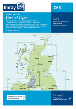
Imray C63 Firth of Clyde Chart
Imray
Current Stock: 0€34.95Imray C63 Firth of Clyde Chart Includes Crinan Approaches (1:10 000) Ardrishaig (1:15 000) East Loch Tarbert (1:12 000) Campbeltown Loch (1:35 000) Campbeltown Harbour (1:7500) Caladh Harbour (1:10 000) Burnt Islands (1:10 000) Rothesay Harbour (1:5000)...49563€34.95 -
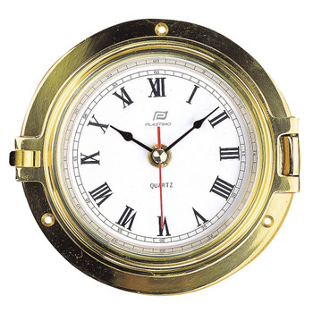
Plastimo 4 1/2" Clock with Solid Brass Case
Plastimo
Current Stock: 4€198.95Plastimo 4.5" boat clock with a solid brass case, bevelled glass edge and quartz mechanism. Bevelled glass edge. Size Front facia Ø : 10cm Base Ø : 14cmP31229€198.95 -
Special OfferSailboats 9m+Universal
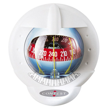
Plastimo Contest 101 Compass - White - Vertical Bulkhead - Conical Card Red
Plastimo
Current Stock: 4Now €171.95Was €172.95The Plastimo Contest 101 is the no. 1 best-selling sailboat compass in the world and it adapts perfectly to today's yachts, both in terms of engineering technique and glamorous design. With its interior and exterior double reading, large crisp card and...P64417Now €171.95Was €172.95 -
Smaller crafts

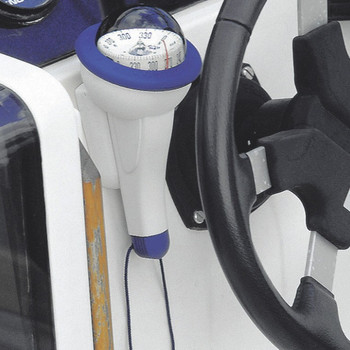
Plastimo Iris 100 Compass with Lighting -Blue
Plastimo
Current Stock: 2€134.95The Plastimo Iris 100 is a truly universal compass and can be used a hand bearing or course compass . It is ideal on sailboats (dinghy, sportsboat, small cruiser), small crafts (kayak, canoe, fishing) or RIBs and even fast motor cruisers, due to...P63875€134.95 -
Sailboats up to 9mUniversal

Plastimo Mini Contest Compass - Black - Vertical Bulkhead - Conical Card Red
Plastimo
Current Stock: 4€130.00The Plastimo Mini-Contest Compass features the legendary accuracy and legibility of the contest card, with a smaller footprint on bulkhead or mast. Ideal on agile sailboats and sports boats up to 9m (30 ft). Features Mounting on vertical...P65742€130.00 -
Powerboats 5-10mUniversal
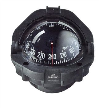
Plastimo Offshore 105 Compass - Black - Flushmount - Conical Card Black
Plastimo
Current Stock: 3€165.00The famous Offshore 105 Compass with built-in articulated hood, is very popular on open dayboats, RIBs, powercruisers and catamarans. It adapts to all steering pods or dashboards and offers optimal readability. Magnetic cell construction features shock...P65001€165.00
A great selection of navigational equipment and instruments - compasses, binoculars, monoculars, barometers, weather instruments, flags, chart equipment, imray charts, sailing books and more from quality brands like Admiralty, Imray, Plastimo, Silva, Weems & Plath, Velocitek and others.


