NAVIGATION-CHARTS-BOOKS
-
NEW!

Irish Tide Tables 2023
Current Stock: 0€4.95The new 2023 edition of the Irish Tide Tables has just been published and is a must-have for all seafarers and those whose lives and property are affected by the sea and tide.In addition to tidal predictions, the booklet also provides precise details for...50001/2023€4.95 -

Sowester Irish Flag - Choice of Sizes
Sowester
Current Stock:€15.95 - €129.95High quality Irish National Flag made from weather resistant woven linen - Comes with a lacing line, with eye one end and loose tail on the opposite end. Size options 9" x 12" 12" x 18" 18" x 36 24" x 36" 24" x 48" 36" x 54" 36" x 60" 36" x...€15.95 - €129.95 -
Special Offer

Plastimo Iris 50 Handbearing Compass with Night Illumination - Yellow
Plastimo
Current Stock: 82Now €84.95Was €116.95The Plastimo Iris 50 is simply the best selling hand bearing compass on the market. Waterproof, shockproof and compact, the Iris 50 fits neatly into your hand and despite its small size, is easy and clear to read. View through the prism to use as a hand...P63871Now €84.95Was €116.95 -

Plastimo Auto-focus 7x50 Binoculars - Black
Plastimo
Current Stock: 0€77.95Easy-to-use 7x50 marine binoculars from Plastimo offering exceptional value for money. Focus-free optics for use from 20m to horizon - no adjustment needed. Features 7 x 50 marine binoculars Easy to use, indispensable on board Rubber fold-down eye...P40561€77.95 -

Sowester Flag Pole - Select Size
Current Stock:€28.95 - €40.95Sowester Flag Pole - Select SizeSowester Flag Pole with 22mm diameter€28.95 - €40.95 -

South and West Coasts of Ireland Sailing Directions [ICC]
Imray
Current Stock: 12€44.95Covers the S & W coasts of Ireland from Carnsore Point (SE) to Bloody Foreland (NW). The standard work on this coast, and many members of the ICC have contributed. This 12th edition has new coloured plans and full-colour photos (mostly aerial views)...49566€44.95 -

Blundell Harling Course Plotter Kit - Portland Plotter & Dividers
Blundell Harling
Current Stock: 0€44.95Chartwork navigation complete with Course Plotter and 7-Inch Singlehanded Dividers Features Used worldwide by practical and shore based instructors Bright blue directional arrow prevents accidental reciprocal bearings Edges are graduated for tide and...49851€44.95 -
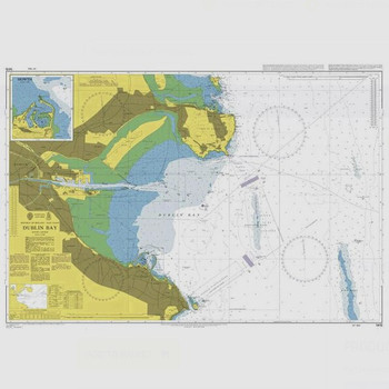
ADMIRALTY Chart 1415: Dublin Bay
Admiralty
Current Stock: 4€46.95ADMIRALTY Chart 1415: Dublin Bay Specifications Scale: 1:25000 Manufacturer: ADMIRALTY Publisher: ADMIRALTY Author: UK Hydrographic Office Edition: Mar-12 Format: Folded to approximately 71.5 x 53.5cm, containing at least...49628€46.95 -


Rite In The Rain 135 Pocket Notebook - Yellow
Rite in the Rain
Current Stock: 0€7.95Rite In The Rain 135 Pocket Notebook in Yellow. This scrappy pocket notebook will survive sweat, rain, mud, snow, oil, grease, and the wear-and-tear of daily use in your pocket. Impact-resistant Wire-O binding won't lose its shape in your back pocket,...49140€7.95 -
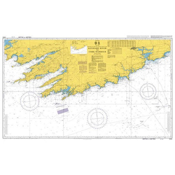
ADMIRALTY Chart 2424: Kenmare River to Cork Harbour
Admiralty
Current Stock: 5€46.95ADMIRALTY Chart 2424: Kenmare River to Cork Harbour Specifications Scale: 1:150000 Manufacturer: ADMIRALTY Publisher: ADMIRALTY Author: UK Hydrographic Office Edition: Nov-16 Format: Folded to approximately 71.5 x 53.5cm,...49712/04€46.95 -
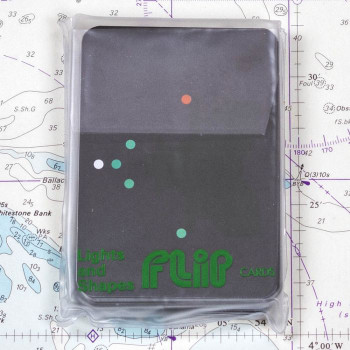

Flip Cards - Lights and Shapes STU0080
Current Stock: 13€11.95An extremely useful set of cards which makes a difficult subject much easier. Each card shows a vessel's display of night-time navigation lights (in colour) or daytime shapes, as seen from your position. In the case of the cards showing lights the...49294€11.95 -

Imray C56 Cork to Dingle Chart
Imray
Current Stock: 23€34.95Imray C56 Cork to Dingle Chart Includes Dingle Harbour (1:25 000) Valentia Harbour (1:32 500) Portmagee (1:30 000) Sneem, Kilmakilloge & Ardgroom Harbours (1:55 000) Castletown Berehaven (1:20 000) Glengarriff Harbour (1:30 000) Bantry Harbour (1:30...49556€34.95 -

Flip Cards IALA Buoyage Area A
Current Stock: 16€11.95All mariners need a comprehensive knowledge of the buoyage rules and should be able to instantly identify a mark at first sight. These Flip Cards show 31 different buoys and navigational marks in colour, with the meaning and position, together with the...49294/5€11.95 -

BH Portland Course Plotter 13"
Blundell Harling
Current Stock: 31€22.95The Blundel Harling Portland Course Plotter is one of the most piece of equipment used in chartwork and navigation and used worldwide by practical and shore based sailors and instructors alike. The Plotter is a ruler, protractor and rotating compass...49850€22.95 -

Silva 58 Kayak Compass
Silva
Current Stock: 10€86.00The Silva Kayak 58 compass is perfect for kayaking or any other small vessels. The compass itself is a liquid filled compass specially designed for marine navigation for accurate readings and a special strap with hooks that can fit this compass onto any...56190/2€86.00 -

Emergency Mayday Card
Current Stock: 7€3.50Keep this handy Mayday Card in the cockpit of your boat for emergency situations. Dimensions: 235 x 160mm This Mayday card takes the user through the DSC Alert and the spoken Mayday procedure, to be kept near your VHF DSC radio. The plastic...49285/9€3.50 -

Imray C55 Dingle Bay to Galway Bay Chart
Imray
Current Stock: 14€34.95Imray C55 Dingle Bay to Galway Bay Chart Includes Cashla Bay (1:30 000) Galway Bay (1:40 000) Galway Harbour (1:15 000) Kilronan (Aran Is.) (1:45 000) River Shannon to Limerick (1:110 000) Kilrush (1:30 000) Foynes Harbour (1:17 500) Fenit Island (1:35...49555€34.95 -

Weems & Plath Parallel Rule - 15" Model 141
Weems & Plath
Current Stock: 21€27.95Of all our traditional parallel rules, the Weems & Plath 15-inch (381mm) Brushed Aluminum Arm Parallel Rule is a best-seller. This sturdy acrylic parallel rule includes a protractor scale, is easy to use, and is a necessary tool for every...49855€27.95 -

Imray C54 Galway Bay to Donegal Bay Chart
Imray
Current Stock: 3€34.95Imray C54 Galway Bay to Donegal Bay Chart Includes Sligo Harbour (1:70 000) Broad Haven Bay (1:75 000) Portnafrankagh (Frenchport) (1:25 000) Achill Sound (1:70 000) Approaches to Westport (1:45 000) Bofin Harbour (Inishbofin) (1:20 000) Cleggan Bay...49554€34.95 -

ADMIRALTY Chart 2129: Long Island Bay to Castlehaven
Admiralty
Current Stock: 10€46.95ADMIRALTY Chart 2129: Long Island Bay to Castlehaven Specifications Scale: 1:30000 Manufacturer: ADMIRALTY Publisher: ADMIRALTY Author: UK Hydrographic Office Edition: Feb-02 Format: Folded to approximately 71.5 x 53...49700€46.95 -

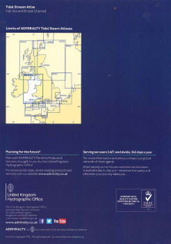
Admiralty Tidal Stream Atlas - NP256 Irish Sea & Bristol Channel - NP256
Admiralty
Current Stock: 1€26.00Admiralty Tidal Stream Atlas NP256 covering Irish Sea and Bristol Channel - Tidal Stream Atlases include detailed tidal stream direction and strength information for key locations in North West Europe enabling accurate calculation of tidal stream rates...49577€26.00 -

Plastimo 8x42 Monocular with Built-In Compass
Plastimo
Current Stock: 2€151.95A waterproof, light and compact 8x42 monocular which integrates a compass with rangefinder to enable the measurement of the size of an object (compass fully operational between 40° and 60° North latitude). Features Waterproof, the instrument can...P61380€151.95 -

ADMIRALTY Chart 2667: Clew Bay and Approaches
Admiralty
Current Stock: 6€46.95ADMIRALTY Chart 2667: Clew Bay and Approaches Specifications Scale: 1:50000 Manufacturer: ADMIRALTY Publisher: ADMIRALTY Author: UK Hydrographic Office Edition: Oct-18 Format: Folded to approximately 71.5 x 53.5cm,...49718/3€46.95 -

C57 Tuskar Rock to Old Head of Kinsale Chart
Imray
Current Stock: 11€34.95C57 Tuskar Rock to Old Head of Kinsale Chart Includes Kinsale Harbour (1:20 000) Cork Lower Harbour (1:35 000) Crosshaven (1:15 000) Youghal Harbour (1:25 000) Dungarvan Harbour (1:32 500) Waterford Harbour (1:55 000) Dunmore East Harbour (1:6000)...49557€34.95 -
Special Offer
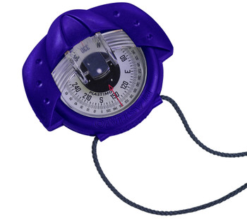
Plastimo Iris 50 Hand bearing Compass with Night Illumination - Blue
Plastimo
Current Stock: 106Now €84.95Was €116.95The Plastimo Iris 50 is simply the best selling hand bearing compass on the market. Waterproof, shockproof and compact, the Iris 50 fits neatly into your hand and despite its small size, is easy and clear to read. View through the prism to use as a hand...P63870Now €84.95Was €116.95 -
With floating belt
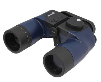

Talamex 7 x 50 Waterproof Binoculars with Compass
Talamex
Current Stock: 3€144.95Talamex waterproof 7x 50 marine grade with built-in illuminated compass. Ideal for leisure or commercial yachting, boating and navigation Features 7 x 50 with BaK-4 lenses. Watertight - Nitrogen filled Illuminated Compass 360°. Calculation...TALAMEX95100196€144.95 -
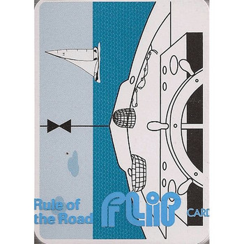
Flip Cards - Rule of the Road Pack STU0070
Current Stock: 4€11.95A pack of cards in a plastic wallet with questions (sometimes pictorial) on one side and the answers on the other. A great way to mug up on those boring but essential aspects of sailing knowledge. One of a series of 8 subject packs.49294/1€11.95 -

Plastimo Twin Scale Clinometer
Plastimo
Current Stock: 8€20.95Indispensable for measuring the optimum angle of heel, for racing dinghies and larger yachts. Designed to be mounted inside or outside. Specifications Screw Diameter : 4 mm Space Between Screws : 90 mm Double Reading Heelmeter: 6° and 45°...P51494€20.95 -
NEW!

Reeds Western Almanac 2024 Ireland & West UK
Reeds
Current Stock: 3€46.00The Reeds Western Almanac covers the coastline from Cape Wrath to Padstow as well as the whole of Ireland, and is ideal for any boater lucky enough to cruise and race in the superb waters off the coast of Western Scotland, Ireland or Western...49570/24€46.00 -

ADMIRALTY Chart 3339: Approaches to Galway Bay including the Aran Islands
Admiralty
Current Stock: 2€46.95ADMIRALTY Chart 3339: Approaches to Galway Bay including the Aran Islands Specifications Scale: 1:50000 Manufacturer: ADMIRALTY Publisher: ADMIRALTY Author: UK Hydrographic Office Edition: Oct-11 Format: Folded to...49721/95€46.95 -

ADMIRALTY Chart 1984: Galway Bay
Admiralty
Current Stock: 5€46.95ADMIRALTY Chart 1984: Galway Bay Specifications Scale: 1:30000 Manufacturer: ADMIRALTY Publisher: ADMIRALTY Author: UK Hydrographic Office Edition: Sep-11 Format: Folded to approximately 71.5 x 53.5cm, containing at least...49682/7€46.95 -

Flip Cards - Sounds, Lights, Distress STU0075
Current Stock: 12€11.95This pack of Flip Cards illustrates the signals made by ships at sea,they cover lights, fog signals and the usual distress, search and rescue signals. The meaning is shown on the back of the card as usual.There are 47 cards in the pack. Illustrates...49294/3€11.95 -

Imray C62 Irish Sea Charts
Imray
Current Stock: 5€34.95Imray C62 Irish Sea Charts Includes Carrickfergus (1:15 000) Bangor Bay (1:17 500) Entrance to Strangford Lough (1:37 500) Portaferry Marina (1:7500) Strangford (1:5000) Ardglass (1:15 000) Entrance to Carlingford Lough (1:26 000) Malahide Inlet (1:35...49562€34.95 -
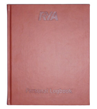

RYA Personal Logbook - G73
RYA
Current Stock: 7€16.95RYA Personal Logbook - G73. This personal logbook is perfect for all boaters who voyage on a number of boats. Within it, there is space to record the distance of journeys, the maximum wind strength and the capacity in which the voyage was sailed. Also...49251/6€16.95 -


Flip Cards - Meteorology Pack STU0090
Current Stock: 20€11.95This Flip Card Meteorology Pack is covered in the UK and Irish waters with particular relevance to the RYA courses. The essential definitions are dealt with and wind forces and their effect on sea states are illustrated well. There are also a number of...49294/2€11.95 -
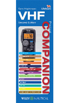
VHF Companion
Fernhurst Books
Current Stock: 19€9.95Features 24 splash proof cards covering every type of radio call - from Mayday to calling another boat or shore station. This 2nd edition contains all relevant updates including the latest technology developments & VHF protocols. PB 24ppAuthor Sara...49285€9.95 -

ADMIRALTY Chart 2495: Kenmare River
Admiralty
Current Stock: 6€46.95ADMIRALTY Chart 2495: Kenmare River Specifications Scale: 1:60000 Manufacturer: ADMIRALTY Publisher: ADMIRALTY Author: UK Hydrographic Office Edition: Nov-16 Format: Folded to approximately 71.5 x 53.5cm, containing at...49715€46.95 -

Plastimo Spare Compass LED Light Assembly 62037- 12v/24v
Plastimo
Current Stock: 20€15.95Replacement light with wire for Plastimo Compasses 12v/24v 62037 This LED light is white and suitable for red carded compasses. If you require a red colour light for none red carded compasses Please add this diffuser: Plastimo Compass Red Light Diffuser...P62037€15.95 -
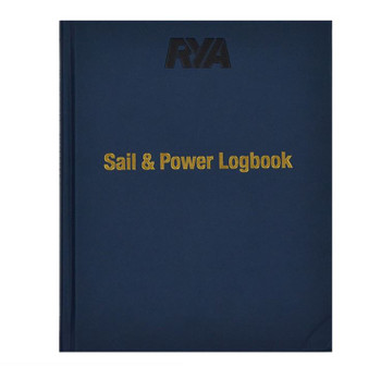
RYA Sail & Power Logbook - G109
RYA
Current Stock: 1€22.99The RYA Sail and Power Logbook combines the previous RYA Sail and Power logbooks into one incredibly useful volume that is ideal for all cruising boaters. This new logbook contains 90 logging pages and the bonus sections include: IALA buoyage;...49251/4€22.99 -
Special Offer

Plastimo Iris 50 Hand Bearing Compass with Night illumination - Olive Green
Plastimo
Current Stock: 9Now €83.95Was €116.95The Plastimo Iris 50 is simply the best selling hand bearing compass on the market. Waterproof, shockproof and compact, the Iris 50 fits neatly into your hand and despite its small size, is easy and clear to read. View through the prism to use as a hand...P63873Now €83.95Was €116.95
A great selection of navigational equipment and instruments - compasses, binoculars, monoculars, barometers, weather instruments, flags, chart equipment, imray charts, sailing books and more from quality brands like Admiralty, Imray, Plastimo, Silva, Weems & Plath, Velocitek and others.


