Navionics
Navionics Platinum+ Italy / Adriatic Sea Chart - MSD/SD Card
- SKU:
- G010-C1318-40
- UPC:
- 8054242923636
- MPN:
- NAV+28XG/UK
Description
Navionics Platinum+ Italy / Adriatic Sea
Coastal coverage of the Po River and the Adriatic coast of Italy, Slovenia, Croatia, Albania, the western coast of Greece and southern Italy. Coverage includes eastern Sicily, the Straits of Messina, the Dalmatian Coast, the Gulf of Taranto, Lago Maggiore, Lago d'Iseo, Lago di Como and Lago di Garda.
Features
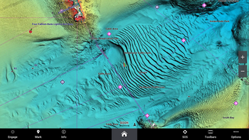
- Nautical Charts
- Daily Chart Updates *
- Dock to Dock Route Guidance
- Up to 1' contours
- Advanced Map Options
- Community Edits
- Plotter Sync
- Sonarchart™ Live Mapping
- High-Resolution Relief Shading*
- Sonar Imagery*
- High-Resolution Satellite Imagery*
- Aerial Photography
- 3D View
*Requires a Navionics subscription to download. A 12-month subscription is included when you purchase a Navionics+ or Navionics Platinum+ chart.
Memory Card Option
- Micro SD Card
Check Your Compatability
Suited to most modern systems, including Lowrance, B&G, Simrad and Raymarine. However, you can check you plotter compatibility on the pdf here.


