Navionics
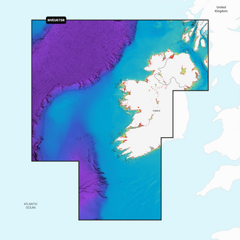
Navionics Platinum+ Ireland West Coast Chart - MSD/SD Card
- SKU:
- G010-C1312-40
- UPC:
- 8056780001302
Description
Coastal coverage of the north and western coasts of Ireland from Cork to Belfast including the entire Shannon Inland and Shannon-Erne Waterways, Galway Bay and Lough Neagh. Also included is the southwestern Scottish coast from Colonsay to Campbelltown.
Features
- Nautical Charts
- Daily Chart Updates *
- Dock to Dock Route Guidance
- Up to 1' contours
- Advanced Map Options
- Community Edits
- Plotter Sync
- Sonarchart™ Live Mapping
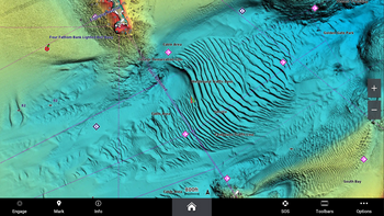
- High-Resolution Relief Shading*
- Sonar Imagery*
- High-Resolution Satellite Imagery*
- Aerial Photography
- 3D View
*Requires a Navionics subscription to download. A 12-month subscription is included when you purchase a Navionics+ or Navionics Platinum+ chart.
Check Your Compatability
The Navionics Platinum+ SD card is suited to most modern systems, including Lowrance, B&G, Simrad and Raymarine. However, you can check you plotter compatibility.


