

C-Map
C-Map XL Discover- Central & Western Europe - M-EW-Y060-MS
- SKU:
- 57799/DISCOVER
- UPC:
- 8053800670548

Special Offer
Valid until 31 May
Description
C-MAP DISCOVER M-EW-Y060-MS - Suits Lowrance®, B&G®, Simrad®-Full-featured Vector Charts with High-Res Bathy, including integrated Genesis® social data, subscription-free Easy Routing™ and Custom Depth Shading
Features
- Full Featured Vector Charts
- Tides & Currents
- Hi Res Bathymetry Layer
- Detailed Marina Port Plans
- Integrated Genesis Layer
- Custom Depth Shading
- 12 Months’ Free Updates
- Subscription-Free Easy Routing
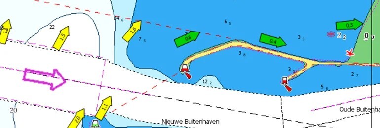
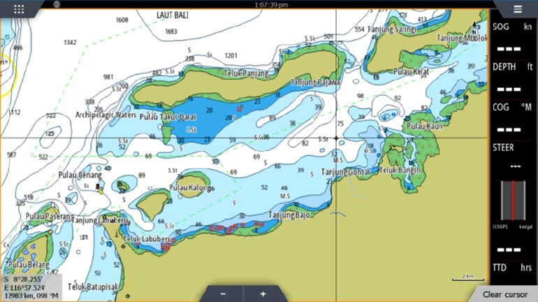
FULL-FEATURED VECTOR CHARTS
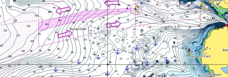
Full-Featured Vector charts make navigation easy by giving you accurate, up-to-date vector chart detail derived from official Hydrographic Office information.
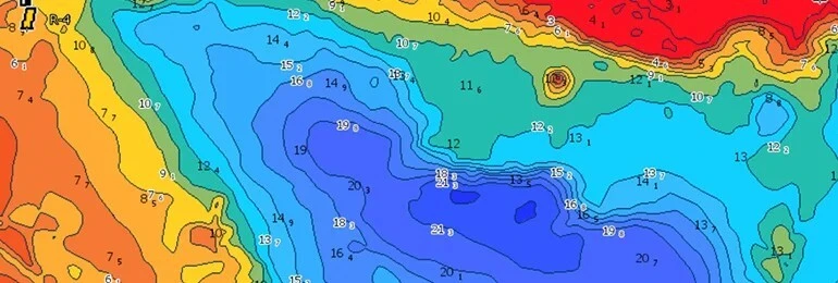
HI-RES BATHYMETRY LAYER
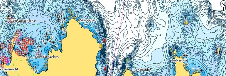
High-Res Bathymetry (HRB) Layer helps you identify shallow areas, drop offs, ledges, holes or humps by accurate contour lines down to 1-foot level of detail. Includes the very best of C-MAP HRB data, including C-MAP Team Lake Surveys (US only) and Genesis® social maps, quality controlled and fully integrated.
CUSTOM DEPTH SHADING
Custom Depth Shading allows you to set a safety depth, maintain a paper-like view or set your own custom shading – see things your way.
EASY ROUTING
Easy Routing helps you automatically plot the shortest, safest route based on detailed chart data and your personalized vessel information. With C-MAP Easy Routing is always subscription free.
TIDES & CURRENTS
Tides & Currents show projections of water level and direction of tides to help plan your day out, whether cruiting, angling or sailing.
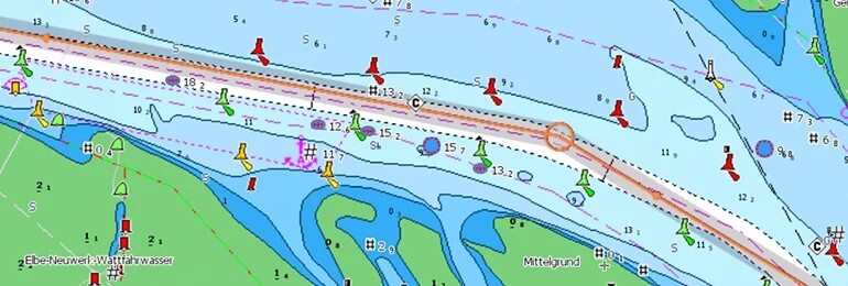
DETAILED MARINA PORT PLANS
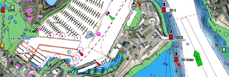
Docking in an unfamiliar port is no problem, when you have precise layouts of thousands of marinas, including slip spaces, restricted areas, and other valuable navigation information.
ENC CARTOGRAPHY OPTION
The new ENC Cartography option allows you to see a representation of the official chart created by the national hydrographic offices around the world*.
*Please be aware that the chart cannot be used in an IMO approved ECDIS System and is not available in all locations.
Related Products
Related Products
Special Offer
Valid until 31 May

C-MAP Discover Chart UK & Ireland - EW-Y200-MS
C-Map
Current Stock: 13
Now
PLN474.50
Was
PLN647.04
Entry-Level Plus quality mapping for all boaters, with accurate, quality data and rich in features, including High-Res Bathymetry and Subscription-Free Easy Routing®. Available in a choice of...
57798/Discover

C-Map Discover X Chart - South Europe
Navico
Current Stock: 0
The C-Map Discover X charts exclusively for Simrad® NSX and the new B&G Zeus S Models covering South Europe Model - M-EM-T-045-D-MS
C-MAP® DISCOVER™ X offers a fresh, dynamic experience...
M-EM-T-045-D-MS
Special Offer
Valid until 31 May


C-MAP Reveal Chart UK & Ireland - M-EW-Y226-MS
C-Map
Current Stock: 6
Now
PLN815.27
Was
PLN1,056.62
REVEAL charts bring you the very best of C-MAP, including game-changing Shaded Relief – bringing the world around and beneath you to life in a completely new way – now available everywhere.
The...
57798/Reveal
Special Offer
Valid until 31 May

C-Map Discover X Chart UK & Ireland EW-T226 SD-CARD
C-Map
Current Stock: 7
Now
PLN517.63
Was
PLN689.96
The C-Map Discover X charts exclusively for Simrad® NSX and the new B&G Zeus S Models covering UK & Ireland Model EW-T226 SD-CARD version
Please enquire about charts for other...
57798/Discover X

C-Map Discover X Chart - East Mediterranean
Navico
Current Stock: 0
The C-Map Discover X charts exclusively for Simrad® NSX and the new B&G Zeus S Models covering the East Mediterranean Model - M-EM-T-111-D-MS SD-CARD version
C-MAP® DISCOVER™ X offers a fresh,...
M-EM-T-111-D-MS


