Admiralty Charts & Portfolios
-

Admiralty Chart 1883 Crohy Head
Admiralty
Current Stock: 1PLN202.52Admiralty Chart 1883 - Crohy Head Specifications Scale: 1:30000 Manufacturer: ADMIRALTY Publisher: ADMIRALTY Author: UK Hydrographic Office Edition: Jan-19 Format: Folded to approximately 71.5 x 53.5cm, containing at least...49682/5PLN202.52 -

Admiralty Chart 20: Ile d'Ouessant to Pointe de la Coubre
Admiralty
Current Stock: 1PLN202.52Admiralty Chart 20: Ile d'Ouessant to Pointe de la Coubre Specifications Scale: 1:500000 Manufacturer: ADMIRALTY Publisher: ADMIRALTY Author: UK Hydrographic Office Edition: Aug-18 Format: Folded to approximately 71.5 x 53...49605PLN202.52 -
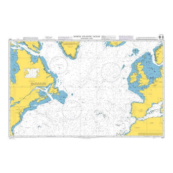
ADMIRALTY Chart 4011: North Atlantic Ocean Northern Part
Admiralty
Current Stock: 2PLN202.52ADMIRALTY Chart 4011: North Atlantic Ocean Northern Part Specifications Scale: 1:10000000 Manufacturer: ADMIRALTY Publisher: ADMIRALTY Author: UK Hydrographic Office Edition: Oct-15 Format: Folded to approximately 71.5 x 53...49727PLN202.52 -
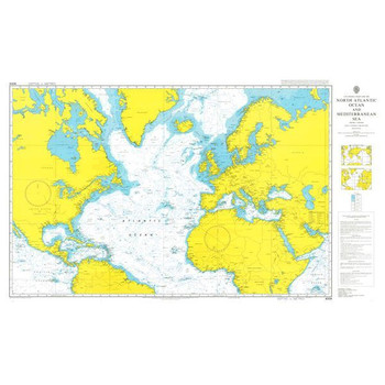
ADMIRALTY Chart 4004: A Planning Chart for the North Atlantic Ocean and Mediterranean Sea
Admiralty
Current Stock: 0PLN202.52ADMIRALTY Chart 4004: A Planning Chart for the North Atlantic Ocean and Mediterranean Sea Specifications Scale: 1:20000000 Manufacturer: ADMIRALTY Publisher: ADMIRALTY Author: UK Hydrographic Office Edition: Oct-14...49726PLN202.52 -

ADMIRALTY Chart 4000: The World
Admiralty
Current Stock: 0PLN202.52ADMIRALTY Chart 4000: The World Specifications Scale: 1:250000 Manufacturer: ADMIRALTY Publisher: ADMIRALTY Author: UK Hydrographic Office Edition: Apr-14 Format: Folded to approximately 71.5 x 53.5cm, containing at least...49725PLN202.52 -
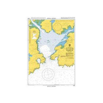
ADMIRALTY Chart 3725: Baltimore Harbour
Admiralty
Current Stock: 2PLN202.52ADMIRALTY Chart 3725: Baltimore Harbour Specifications Scale: 1:6250 Manufacturer: ADMIRALTY Publisher: ADMIRALTY Author: UK Hydrographic Office Edition: Nov-91 Format: Folded to approximately 71.5 x 53.5cm, containing at...49722PLN202.52 -

ADMIRALTY Chart 3339: Approaches to Galway Bay including the Aran Islands
Admiralty
Current Stock: 2PLN202.52ADMIRALTY Chart 3339: Approaches to Galway Bay including the Aran Islands Specifications Scale: 1:50000 Manufacturer: ADMIRALTY Publisher: ADMIRALTY Author: UK Hydrographic Office Edition: Oct-11 Format: Folded to...49721/95PLN202.52 -

ADMIRALTY Chart 3338: Kilkee to Inisheer
Admiralty
Current Stock: 2PLN202.52ADMIRALTY Chart 3338: Kilkee to Inisheer Specifications Scale: 1:50000 Manufacturer: ADMIRALTY Publisher: ADMIRALTY Author: UK Hydrographic Office Edition: Sep-12 Format: Folded to approximately 71.5 x 53.5cm, containing at...49721/94PLN202.52 -
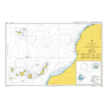
ADMIRALTY Chart 3133: Casablanca to Islas Canarias (Including Arquipelago da Madeira)
Admiralty
Current Stock: 1PLN202.52ADMIRALTY Chart 3133: Casablanca to Islas Canarias (Including Arquipelago da Madeira) Specifications Scale: 1:1250000 Manufacturer: ADMIRALTY Publisher: ADMIRALTY Author: UK Hydrographic Office Edition: May-19...49721/91PLN202.52 -
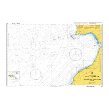
ADMIRALTY Chart 3132: Strait of Gibraltar to Arquipelago da Madeira
Admiralty
Current Stock: 2PLN202.52ADMIRALTY Chart 3132: Strait of Gibraltar to Arquipelago da Madeira Specifications Scale: 1:1250000 Manufacturer: ADMIRALTY Publisher: ADMIRALTY Author: UK Hydrographic Office Edition: Jun-17 Format: Folded to approximately...49721/90PLN202.52 -

ADMIRALTY Chart 3000: La Rochelle to Pointe de la Coubre (Including Ile d'Oleron)
Admiralty
Current Stock: 2PLN202.52ADMIRALTY Chart 3000: La Rochelle to Pointe de la Coubre (Including Ile d'Oleron) Specifications Scale: 1:50000 Manufacturer: ADMIRALTY Publisher: ADMIRALTY Author: UK Hydrographic Office Edition: Sep-17 Format: Folded to...49721/80PLN202.52 -

ADMIRALTY Chart 2800: Carlingford Lough
Admiralty
Current Stock: 0PLN202.52ADMIRALTY Chart 2800: Carlingford Lough Specifications Scale: 1:20000 Manufacturer: ADMIRALTY Publisher: ADMIRALTY Author: UK Hydrographic Office Edition: Mar-15 Format: Folded to approximately 71.5 x 53.5cm, containing at...49721/21PLN202.52 -
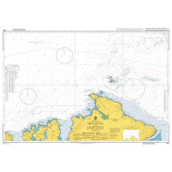
ADMIRALTY Chart 2811: Sheep Haven to Lough Foyle Including Inishtrahull
Admiralty
Current Stock: 0PLN202.52ADMIRALTY Chart 2811: Sheep Haven to Lough Foyle Including Inishtrahull Specifications Scale: 1:75000 Manufacturer: ADMIRALTY Publisher: ADMIRALTY Author: UK Hydrographic Office Edition: Mar-13 Format: Folded to...49721/20PLN202.52 -

ADMIRALTY Chart 2792: Plans on the North-West Coast of Ireland
Admiralty
Current Stock: 2PLN202.52ADMIRALTY Chart 2792: Plans on the North-West Coast of Ireland Specifications Scale: 1:250000 Manufacturer: ADMIRALTY Publisher: ADMIRALTY Author: UK Hydrographic Office Edition: Jan-19 Format: Folded to approximately 71.5...49721/2PLN202.52 -

ADMIRALTY Chart 2790: Ireland - West Coast, Ventry and Dingle Harbours
Admiralty
Current Stock: 0PLN202.52ADMIRALTY Chart 2790: Ireland - West Coast, Ventry and Dingle Harbours Specifications Scale: 1:250000 Manufacturer: ADMIRALTY Publisher: ADMIRALTY Author: UK Hydrographic Office Edition: Jan-14 Format: Folded to...49721/1PLN202.52 -

ADMIRALTY Chart 2789: Dingle Bay and Smerwick Harbour
Admiralty
Current Stock: 4PLN202.52ADMIRALTY Chart 2789: Dingle Bay and Smerwick Harbour Specifications Scale: 1:60000 Manufacturer: ADMIRALTY Publisher: ADMIRALTY Author: UK Hydrographic Office Edition: Nov-16 Format: Folded to approximately 71.5 x 53.5cm,...49721PLN202.52 -

ADMIRALTY Chart 2767: Porturlin to Sligo Bay and Rathlin O'Birne Island
Admiralty
Current Stock: 1PLN202.52ADMIRALTY Chart 2767: Porturlin to Sligo Bay and Rathlin O'Birne Island Specifications Scale: 1:75000 Manufacturer: ADMIRALTY Publisher: ADMIRALTY Author: UK Hydrographic Office Edition: Jan-19 Format: Folded to...49720/05PLN202.52 -

ADMIRALTY Chart 2739: Brandon and Tralee Bays
Admiralty
Current Stock: 6PLN202.52ADMIRALTY Chart 2739: Brandon and Tralee Bays Specifications Scale: 1:37500 Manufacturer: ADMIRALTY Publisher: ADMIRALTY Author: UK Hydrographic Office Edition: Oct-12 Format: Folded to approximately 71.5 x 53.5cm,...49720PLN202.52 -

ADMIRALTY Chart 2704: Blacksod Bay and Approaches
Admiralty
Current Stock: 2PLN202.52ADMIRALTY Chart 2704: Blacksod Bay and Approaches Specifications Scale: 1:50000 Manufacturer: ADMIRALTY Publisher: ADMIRALTY Author: UK Hydrographic Office Edition: Oct-18 Format: Folded to approximately 71.5 x 53.5cm,...49719/5PLN202.52 -

ADMIRALTY Chart 2725: Blacksod Bay to Tory Island
Admiralty
Current Stock: 3PLN202.52ADMIRALTY Chart 2725: Blacksod Bay to Tory Island Specifications Scale: 1:200000 Manufacturer: ADMIRALTY Publisher: ADMIRALTY Author: UK Hydrographic Office Edition: Jul-16 Format: Folded to approximately 71.5 x 53.5cm,...49719/4PLN202.52 -

ADMIRALTY Chart 2723: Western Approaches to the North Channel
Admiralty
Current Stock: 1PLN202.52ADMIRALTY Chart 2723: Western Approaches to the North Channel Specifications Scale: 1:200000 Manufacturer: ADMIRALTY Publisher: ADMIRALTY Author: UK Hydrographic Office Edition: Jul-15 Format: Folded to...49719/3PLN202.52 -

ADMIRALTY Chart 2715: Killala and Donegal
Admiralty
Current Stock: 3PLN202.52ADMIRALTY Chart 2715: Killala and Donegal Specifications Scale: 1:250000 Manufacturer: ADMIRALTY Publisher: ADMIRALTY Author: UK Hydrographic Office Edition: May-10 Format: Folded to approximately 71.5 x 53.5cm,...49719/13PLN202.52 -
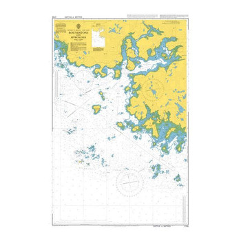
ADMIRALTY Chart 2709: Roundstone and Approaches
Admiralty
Current Stock: 1PLN202.52ADMIRALTY Chart 2709: Roundstone and Approaches Specifications Scale: 1:30000 Manufacturer: ADMIRALTY Publisher: ADMIRALTY Author: UK Hydrographic Office Edition: Oct-18 Format: Folded to approximately 71.5 x 53.5cm,...49719/10PLN202.52 -

ADMIRALTY Chart 2706: Ballynakill and Killary Harbours with Approaches
Admiralty
Current Stock: 2PLN202.52ADMIRALTY Chart 2706: Ballynakill and Killary Harbours with Approaches Specifications Scale: 1:25000 Manufacturer: ADMIRALTY Publisher: ADMIRALTY Author: UK Hydrographic Office Edition: Oct-18 Format: Folded to...49719/08PLN202.52 -

ADMIRALTY Chart 2703: Broad Haven Bay and Approaches
Admiralty
Current Stock: 3PLN202.52ADMIRALTY Chart 2703: Broad Haven Bay and Approaches Specifications Scale: 1:50000 Manufacturer: ADMIRALTY Publisher: ADMIRALTY Author: UK Hydrographic Office Edition: Jul-16 Format: Folded to approximately 71.5 x 53.5cm,...49719/06PLN202.52 -

ADMIRALTY Chart 2702: Donegal Bay
Admiralty
Current Stock: 2PLN202.52ADMIRALTY Chart 2702: Donegal Bay Specifications Scale: 1:60000 Manufacturer: ADMIRALTY Publisher: ADMIRALTY Author: UK Hydrographic Office Edition: Jan-19 Format: Folded to approximately 71.5 x 53.5cm, containing at least...49719/05PLN202.52 -
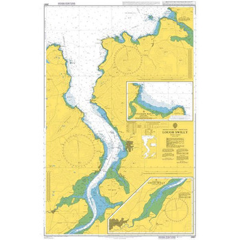
ADMIRALTY Chart 2697: Lough Swilly
Admiralty
Current Stock: 3PLN202.52ADMIRALTY Chart 2697: Lough Swilly Specifications Scale: 1:37500 Manufacturer: ADMIRALTY Publisher: ADMIRALTY Author: UK Hydrographic Office Edition: Jul-11 Format: Folded to approximately 71.5 x 53.5cm, containing at least...49719PLN202.52 -

ADMIRALTY Chart 2699: Horn Head to Fanad Head with Mulroy Bay
Admiralty
Current Stock: 2PLN202.52ADMIRALTY Chart 2699: Horn Head to Fanad Head with Mulroy Bay Specifications Scale: 1:30000 Manufacturer: ADMIRALTY Publisher: ADMIRALTY Author: UK Hydrographic Office Edition: Jan-14 Format: Folded to approximately 71.5 x...49718/33PLN202.52 -

ADMIRALTY Chart 2675: English Channel
Admiralty
Current Stock: 4PLN202.52ADMIRALTY Chart 2675: English Channel Specifications Scale: 1:500000 Manufacturer: ADMIRALTY Publisher: ADMIRALTY Author: UK Hydrographic Office Edition: Mar-19 Format: Folded to approximately 71.5 x 53.5cm, containing at...49718/31PLN202.52 -

ADMIRALTY Chart 2667: Clew Bay and Approaches
Admiralty
Current Stock: 6PLN202.52ADMIRALTY Chart 2667: Clew Bay and Approaches Specifications Scale: 1:50000 Manufacturer: ADMIRALTY Publisher: ADMIRALTY Author: UK Hydrographic Office Edition: Oct-18 Format: Folded to approximately 71.5 x 53.5cm,...49718/3PLN202.52 -
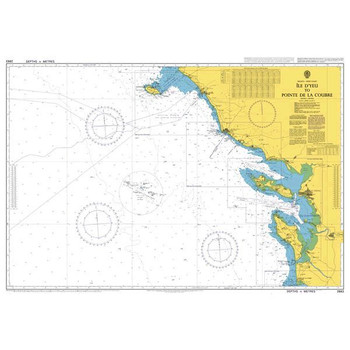
ADMIRALTY Chart 2663: Ile D'Yeu to Pointe de la Coubre
Admiralty
Current Stock: 0PLN202.52ADMIRALTY Chart 2663: Ile D'Yeu to Pointe de la Coubre Specifications Scale: 1:200000 Manufacturer: ADMIRALTY Publisher: ADMIRALTY Author: UK Hydrographic Office Edition: Aug-13 Format: Folded to approximately 71.5 x...49717PLN202.52 -

ADMIRALTY Chart 2565: Saint Agnes Head to Dodman Point Including the Isles of Scilly
Admiralty
Current Stock: 2PLN202.52ADMIRALTY Chart 2565: Saint Agnes Head to Dodman Point Including the Isles of Scilly Specifications Scale: 1:150000 Manufacturer: ADMIRALTY Publisher: ADMIRALTY Author: UK Hydrographic Office Edition: Sep-12 Format: Folded...49716/5PLN202.52 -

ADMIRALTY Chart 2552: Dunmanus Bay
Admiralty
Current Stock: 3PLN202.52ADMIRALTY Chart 2552: Dunmanus Bay Specifications Scale: 1:30000 Manufacturer: ADMIRALTY Publisher: ADMIRALTY Author: UK Hydrographic Office Edition: Jul-11 Format: Folded to approximately 71.5 x 53.5cm, containing at least...49716PLN202.52 -

ADMIRALTY Chart 2495: Kenmare River
Admiralty
Current Stock: 5PLN202.52ADMIRALTY Chart 2495: Kenmare River Specifications Scale: 1:60000 Manufacturer: ADMIRALTY Publisher: ADMIRALTY Author: UK Hydrographic Office Edition: Nov-16 Format: Folded to approximately 71.5 x 53.5cm, containing at...49715PLN202.52 -

ADMIRALTY Chart 2046: Waterford Harbour
Admiralty
Current Stock: 4PLN202.52ADMIRALTY Chart 2046: Waterford Harbour Specifications Scale: 1:25000 Manufacturer: ADMIRALTY Publisher: ADMIRALTY Author: UK Hydrographic Office Edition: Jan-17 Format: Folded to approximately 71.5 x 53.5cm, containing at...49714PLN202.52 -

ADMIRALTY Chart 2423: Mizen Head to Dingle Bay
Admiralty
Current Stock: 1PLN202.52ADMIRALTY Chart 2423: Mizen Head to Dingle Bay Specifications Scale: 1:150000 Manufacturer: ADMIRALTY Publisher: ADMIRALTY Author: UK Hydrographic Office Edition: Nov-16 Format: Folded to approximately 71.5 x 53.5cm,...49713PLN202.52 -
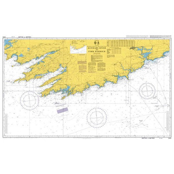
ADMIRALTY Chart 2424: Kenmare River to Cork Harbour
Admiralty
Current Stock: 4PLN202.52ADMIRALTY Chart 2424: Kenmare River to Cork Harbour Specifications Scale: 1:150000 Manufacturer: ADMIRALTY Publisher: ADMIRALTY Author: UK Hydrographic Office Edition: Nov-16 Format: Folded to approximately 71.5 x 53.5cm,...49712/04PLN202.52 -

ADMIRALTY Chart 2420: Aran Islands to Broad Haven Bay
Admiralty
Current Stock: 2PLN202.52ADMIRALTY Chart 2420: Aran Islands to Broad Haven Bay Specifications Scale: 1:150000 Manufacturer: ADMIRALTY Publisher: ADMIRALTY Author: UK Hydrographic Office Edition: Jul-16 Format: Folded to approximately 71.5 x...49712PLN202.52 -

ADMIRALTY Chart 2254: Valentia Island to River Shannon
Admiralty
Current Stock: 4PLN202.52ADMIRALTY Chart 2254: Valentia Island to River Shannon Specifications Scale: 1:150000 Manufacturer: ADMIRALTY Publisher: ADMIRALTY Author: UK Hydrographic Office Edition: Nov-16 Format: Folded to approximately 71.5 x 53...49711PLN202.52 -

ADMIRALTY Chart 2184: Mizen Head to Gascanane Sound
Admiralty
Current Stock: 6PLN202.52ADMIRALTY Chart 2184: Mizen Head to Gascanane Sound Specifications Scale: 1:30000 Manufacturer: ADMIRALTY Publisher: ADMIRALTY Author: UK Hydrographic Office Edition: Aug-12 Format: Folded to approximately 71.5 x 53.5cm,...49710PLN202.52


